Sometimes I have to put text on a path
Showing posts with label content management. Show all posts

Friday, November 23, 2012

Upload PDFs using Mendeley website interface


When I'm at a computer without Mendeley Desktop installed, I would like to be able to add a reference/document by uploading the PDF to the website. Currently, the 'Add Document' button on the website only allows for manually adding the reference info. Pressing 'Add Document' should also bring up a Browse button that allows you to locate and upload a document from your computer to the web.

One way to do this at the moment is to use the Chrome browser app Metatato, which is in online interface for Mendeley. You can drag and drop pdfs to entries in your library.
www.metatato.com/

https://chrome.google.com/webstore/search/metatato?hl=en-GB

Sunday, September 30, 2012

upload , embed pdf, word excel in bogger blogspot


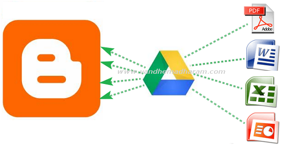
Most of bloggers using Google's free blogger platform. Even though it has more features you cannot upload pdf, doc, xls files directly on blogger. So before we used third party websites to embed these files. But now you no need to go to thirt party websites you can embed documents, spreadsheets, PDF files using Google Drive. Google is a Google's recent released cloud storage service it has more useful features . Here below the tutorial to how to embed doc,xls,pdf files on Google Drive.

  • Open drive.google.com and login to your account then click the upload button and choose your files need to embed.
  • After upload completed click on the uploaded file link. It opens in new tab


  • Then go to File - Embed (this PDF file) in menu bar. 


  • After you hit the Embed option the embed coding will shows just copy that coding and paste it on Edit HTML mode in blogger post editor section. 


  • Then as usual hit the publish Post button your embed files shows in blog posts.
I think this is the very easy way to show these type of files on blogger posts. If you have other ideas please share it on comment section. 

ref: http://www.techshortly.com/2012/05/how-to-show-pdf-doc-xls-files-on.html#

Tuesday, November 15, 2011

content management system (CMS): plone.org; open source

Plone is among the top 2% of all open source projects worldwide, with 340 core developers and more than 300 solution providers in 57 countries (available in more than 40 languages).
http://plone.org/

Plone lets non-technical people create and maintain website content using only a web browser. Plone offers a rich set of capabilities for public websites, private intranets and collaborative workspaces.

demo: http://plone-demo.sixfeetup.com/


A CMS allows users to create, manage and publish content to a website without requiring a high level of technical skill.

As websites have grown larger and more complex, content management systems like Plone have grown in popularity, since they provide an efficient, easy way for people to create and edit content in a consistent, secure and controllable fashion. CMSes also enable website visitors to interact with content and with each other by contributing comments, ratings, submitting forms and more.


Plone comes with a reliable, secure, easy-to-administer object database backend known as the ZODB (Zope Object Database). In addition, Plone can easily connect to data stored in Active Directory, LDAP, Salesforce.com, SQL databases, and more.

A free Plone add-on, RelStorage, also allows enterprises with investments in Oracle, MySQL and PostgreSQL to store the data driving their Plone site in their existing infrastructure to be able to make use of familiar tools, clustering and failover solutions.


How does Plone compare with Sharepoint, Drupal, Alfresco and Joomla?
Plone is a true CMS with built-in publication workflow and document management features, unlike other systems such as Sharepoint or Alfresco, which are primarily document management systems with limited web functionality. This makes Plone ideal for intranets and extranets.

Plone can be customized and extended to meet the specific needs of an organization in terms of site structure, content types, workflow rules, etc. Not all CMSes offer the same level of flexibility.

Because it is built on top of Python and Zope, Plone is very secure, which is a reason why many switch from Joomla and Drupal to Plone.

Plone is 100% open source, so released, stable versions can be downloaded for free. There's no need to purchase a per-server or per-user license to get commercial support, as is the case with Alfresco or Sharepoint.

Thursday, September 1, 2011

all about geodata and wikipedia; geoHack, geonames (8 million placenames) and geoweb; GIS, digital earth; 1.7 million geo-coordinates entries as input in wikipedia (all languages)

WikiProject Geographical coordinates aims to better organize location information in articles containing a set of numbers that identifies location on and relative to the Earth. In particular, this wikiProject aims to establish a standard for uniform handling of latitude and longitude coordinates as given in various Wikipedia articles, somewhat analogous to how ISBN numbers are handled.
The Wikiproject Geographical coordinates is busy tagging all articles about locations on Earth with their geographic coordinates using the coor family of tags; this gives readers access to maps and aerial photography and allows external sites to create mashups showing Wikipedia articles on maps.

http://en.wikipedia.org/wiki/Wikipedia:WikiProject_Geographical_coordinates

1.72 million geo-coordinates entries as input in wikipedia (all languages) -july 2011
This is the international co-ordination page for the multilingual usage and analysis of the geographical data collected.Thanks to the free availability of the collected data and thanks to the innumerable helpers who attach geo information to the articles, it is possible to describe the position of locations with the degrees of longitude and latitude in ALL languages by using maps. 
It uses the links to geohack (see below) which are in the database in the external link table. Via the interwiki links all language variants are analyzed and recorded in a common database. In order to achieve this, a co-ordination on the used geographical coordinates templates is necessary.
All people with toolserver-account can read and use the database kolossos on server ptolemy.

toolserver.org:
World map with a representation of the concentration of wikipoints:

example of a US laboratory geo-data: http://toolserver.org/~geohack/geohack.php?pagename=Geoweb&params=40_8_58.9_N_88_16_22.7_W_&title=U.S.+Army+Construction+Engineering+Research+Laboratory (see how many maps are available in US)
example of a country: see the right column "capital" http://en.wikipedia.org/wiki/France and
http://toolserver.org/~geohack/geohack.php?pagename=France&params=48_51.4_N_2_21.05_E_type:country
You can get many data: available maps, wkipedia layers, photos, Other information

View Wikipedia in Google Earth:
Project Wikipedia-World scan 11 Dumps (ca,cs,de,en,eo,es,fi,fr,nl,pt,ru) and provides:
dynamic Google-Earth layers in 21 languages. 
static Google-Earth layers in 10 language with different folders (Castles, Parks,...), Download at http://www.webkuehn.de/hobbys/wikipedia/geokoordinaten/index_en.htm
SQL-Data off all scanned coordinates.

Visualization of Wikipedia articles with Google Maps:
Geonames:
www.geonames.org over 800000 Wikipedia articles in 230 languages on Google maps.
The placemarks include short descriptions of the displayed items, extracted from the Wikipedia articles. Webservices for full text search and reverse geocoding of wikipedia articles.
The GeoNames geographical database covers all countries and contains over 8 million placenames that are available for download free of charge. http://www.geonames.org/statistics/ (DATA @ august 2011) USA: 2000000 names ; 260 000 China: 260000 names; Germany 180000; France 120000 names; UK 50000names; India: 50000 names...
http://www.geonames.org/statistics/france.html:
37000 administrative boundaries; 5600 hydrographic features; 314 area features (park...); 60000 population features; 34 Railroad Features; 10000 Spot Features (spot, building...); 6000 Hypsographic Features (mountain, hill, rock,... ); 2600 Vegetation Features (forest,heath,...).
http://www.geonames.org/maps/wikipedia.html:
french: 222000entries.
example St-Etienne, France: http://www.geonames.org/maps/bkm14837
You can create account and get a small content management.

Use the JSON services (http://www.geonames.org/export/JSON-webservices.html) if you want to use GeoNames from javascript:
http://www.geonames.org/export/web-services.html

You can download dump files: http://www.geonames.org/export/:
http://download.geonames.org/export/dump/FR.zip

geonames blog:
http://geonames.wordpress.com/2011/04/29/historical-place-names/
Improving the way GeoNames handles historical names is a popular feature request. GeoNames is now beginning to address this question. There are two new flags in the alternate name edit tool:isHistoric for names of the past that are no longer used.isColloquial for slang and colloquial namesAt the recent Annual Meeting of the Association of American Geographers is was discussed how GeoNames could be extended to improve support for the timeline. Some attributes under consideration:- fromPeriod (date, year, decade, century or period of usage)- toPeriod- source (book or map where the name is used), publication date of the source- notes
http://geonames.wordpress.com/2008/03/06/geotree-hierarchical-toponym-browser/

http://geotree.geonames.org/
GeoTree is a new hierarchical toponym browser for GeoNames. It allows to drill down the continents and the administrative divisions of a country in an explorer like fashion. To the right of the tree view a map shows the toponym selected. An outstanding component of GeoTree are the flags and coat of arms displayed with most administrative features. The GeoNames balloons are linking to the respective GeoTree representation of the toponym. GeoTree is using the GeoNames hierarchical webservices.

Gisgraphy http://www.gisgraphy.com/ : Importer, geolocalisation and fulltext services for Geonames and Openstreetmap. It's a free and open source framework. Gisgraphy goal is to provide tools to use free GIS Data on the Web via REST webservices . Actually it manage Geonames and OpenStreetMap (42 million entries). it provides an importer to inject the data into a strongly typed Postgres / Postgis database and use them via webservices : worldwide geocoding, worldwide reverse geocoding, fulltext and find nearby. Results can be output in XML, Atom, RSS, JSON, PHP, Ruby, and Python.
example (Paris, one rond-point Champs elysees; in json format) : http://services.gisgraphy.com/street/streetsearch?format=json&lat=48.85340881347656&lng=2.34879994392395&from=1&to=10&name=Champs%20e&mode=contains

GeoHack is a Coordinates search tool.
http://toolserver.org/~dispenser/cgi-bin/geosearch.py
It's a modified version of map sources from Egil Kvaleberg's gis extension. It is designed to do simple HTML replacements of a template on Wikipedia and serve it to the client. It is used by Wikipedia to provide links to various mapping services, when a user clicks on a link with geographical coordinates.
All parameters (query URL; The D_M_S_N_D_M_S_E, D_M_N_D_M_E, D_N_D_E, or D;D where D is degrees, M is minutes, S is seconds, and NS/EWO are the directions):
https://wiki.toolserver.org/view/GeoHack
Replace external links to GeoHack with direct links to a single mapping provider:
https://wiki.toolserver.org/view/GeoHack/Replacement_script

The Wikimedia Toolserver is a collaborative platform that provides hosting and support for various software tools written and used by Wikimedia contributors:
https://wiki.toolserver.org/view/Main_Page
try: http://toolserver.org/~geohack/

---------map sources from Egil Kvaleberg's gis extension
http://www.mediawiki.org/wiki/Extension:Gis/map_sources
http://www.mediawiki.org/wiki/Extension:Gis

The gis extension implements the tag, the Map sources and the Neighbors function, in addition to support of other map resources.


WikiMiniAtlas
http://meta.wikimedia.org/wiki/WikiMiniAtlas
WikiMiniAtlas is a Javascript plugin to display a (draggable, zoomable, and clickable) worldmap in geocoded Wikipedia articles. The map contains links to all other geocoded articles in Wikipedia (and can be magnified down to approximate 100m resolution worldwide). While it looks similar to GoogleMaps it is our own software and free data.
WikiMiniAtlas is currently enabled on Wikipedia (by clicking on the globe (Erioll world.svg) beside the coordinates).

Displaying content from toolserver.org to maps.google
The content displayed below and overlaid onto this map is provided by toolserver.org (point of interest and direct link to wikipedia articles). See the following URL:
http://maps.google.com/maps?q=http://toolserver.org/~para/cgi-bin/kmlexport?article=Colmar_Pocket
see http://en.wikipedia.org/wiki/Colmar_Pocket
Only the english version of this wikipedia article (Colmar pocket) has many geocoordinate data by places.


wikipedia and Google extraction
As for appearing on Google Maps and Google Earth, Google takes a snapshot of Wikipedia every few months and selects data from that.
Only articles using {{coord}} with display=title (or display=inline,title) are extracted.

Export multiple coordinates
Kmlexport tool (http://toolserver.org/~para/cgi-bin/kmlexport): Pages marked with multiple coordinates or categories of articles with coordinates can be exported as KML (for use in Google Earth, for example). This tool and some alternatives can be found on clicking the coordinates or by applying the {{GeoGroupTemplate}} template on a page.
The Kmlexport can be used directly or through Google Maps; see for example Colmar Pocket (see above; save "my maps" and export to KML).

How to add geocodes to articles?
http://en.wikipedia.org/wiki/Wikipedia:How_to_add_geocodes_to_articles
Coordinate data makes an article eventually appear in various services such as Google Maps Wikipedia overlay, Google Earth, and Wikimedia's map service.

Wikipedia project pages of interest:
  • Categorization of location, proposal to generate lists of articles about nearby locations from a given Wikipedia article
  • Coordinate-referenced map templates, inactive guidline proposal for using coordinate-referenced map templates to generate maps in wikipedia articles
  • Geographic references, a list of sources used in the creation of encyclopedia articles on various geographic topics and locations. Finding lat/long info: 7 links; Finding lat/long info in Google Earth; 
  • Geonotice, location targeted messages using geocoordiates to announce upcoming Wikipedia meetups and local events. A geonotice is a notice similar to a sitenotice, anonnotice or watchlist notice, but it is displayed only to users who are physically located in some subset of the Earth. The purpose of geonotices is to announce events that would be of great interest to people in a specific region, but that would not be interesting to most of our readers. The use of targeted messages allows us to scale our communication better; rather than flooding people with multiple messages or avoiding messages entirely, we can display messages only to the people who are most likely to find them useful.
  • How to add geocodes to articles, a short guide to how to add geographic coordinate tags to Wikipedia articles
  • How to add geocodes to articles by User:EncMstr, EncMstr's guide on how to enter coordinate data using {{coord}}
  • MoS Geographical coordinates, Official style guideline on geographical coordinates
  • Mobile access, How to use a mobile phone to search for geotagged Wikipedia articles near your current location
  • Obtaining geographic coordinates, listing various ways on how to obtain geographic coordinates for use in an article.
  • Version_1.0_Editorial_Team/WPPlaces, Version 1.0 Editorial Team contact results with WikiProject Geographical coordinates
  • WikiProject Maps/Source materials, list of free maps for use in creating geographical maps for Wikipedia.


Tuesday, August 23, 2011

Geo Content Management System; comparison of Drupal, Plone, Midgard, Zikula

google maps is a Map server with a low management system (http://ex-ample.blogspot.com/2011/08/geography-gis-google-maps-javascript.html).

http://drupal.org/  alexa (data@august 2011): 390
 It is used as a back-end system for at least 1.5% of all websites worldwide. Because of its plug-in extensibility and modular design (>10000 plugins), Drupal is sometimes described as a content management framework. geospatial modules: http://groups.drupal.org/node/89769
http://www.midgard-project.org/  alexa (data@august 2011): 476 000
http://plone.org/  alexa (data@august 2011): 31 700;
python >57% and Javascript 29% http://www.ohloh.net/p/plone/analyses/latest
http://plone.org/support/sites/sites_listing?industries%3Alist=&countries%3Alist=
http://zikula.org/  alexa (data@august 2011): 70 100
 usermap: http://community.zikula.org/module-GoogleMap.htm

These open source Geo Content Management System are Content Management System where "objects" (users, articles, blogs and images..) can have a Latitude, Longitude position to be displayed on an online interactive map. The online maps link to informational pages/ metadata (wiki pages essentially) on the data represented. They have a map of registered users allowing to build communities geographically, by looking at users location.

The number of locations per content item is not limited to one (as TikiWiki http://info.tiki.org/tiki-index.php; alexa (data@august 2011): 54 000; Tiki contains a number of collaboration features allowing it to operate as a Geo Content Management System).

As a default map source we can select
-OpenStreetMap http://www.openstreetmap.org/,
-Google Maps http://maps.google.com/,
-Yahoo Maps http://maps.yahoo.com/ or
-Bing Maps http://www.bing.com/maps/.

Syndication formats: GeoRSS, KML.

To display the maps, these services sometimes  take advantage of  Openlayers, a JavaScript library for displaying map data in web browsers, with no server-side dependencies: http://www.openlayers.org/


Tuesday, July 19, 2011

How to post mathematics in wikipedia or in MediaWiki? the MediaWiki API and extensions


How to write mathematics in blog/sites (not wiki)?
See this post:
http://ex-ample.blogspot.com/2011/07/mathml-chromefirefox-and-best.html

An ex-ample : the online  NIST Digital Library of Mathematical Functions {Abramowitz and Stegun’s (1964) Handbook of Mathematical Functions with Formulas, Graphs, and Mathematical Tables}.
http://ex-ample.blogspot.com/2011/07/best-ex-ample-nist-digital-library-of.html

The first steps for writing/test your equation/formula in wikipedia:
------------
The operation of Wikipedia depends on MediaWiki, a custom-made, free and open source wiki software platform written in PHP and built upon the MySQL database. If you want to compare wiki: http://www.wikimatrix.org/
http://en.wikipedia.org/wiki/Comparison_of_wiki_software
------------

MediaWiki has 3 interfaces (http://www.mediawiki.org/wiki/API):
  • the MediaWiki API, which provides convenient access to wiki features, data and meta-data. 
  • the Special:Export page, which provides bulk export of wiki content as XML. Read the Export help article on meta.mediawiki.org for more information.
  • the standard web-based interface.
Extensions:
---version of mediaWiki used by wikipedia:
http://en.wikipedia.org/wiki/Special:Version#Installed_extensions

---inserting unusual characters:
http://www.mediawiki.org/wiki/Extension:CharInsert allows creation of JavaScript box for inserting unusual characters.
or copy/paste from: http://en.wikipedia.org/wiki/MediaWiki:Edittools

---mathematics, formula, equations:
Mediawiki des not have an integrated equation editor.
It only has a LaTeX rendering: you have to write or copy/paste a latex code  between HTML math-tags.
Then it's painful if you want to write pages on Math with a LARGE number of math equations (and symbols, graphs...), easily.


Mediawiki and MathML and LaTeX:
http://www.gossamer-threads.com/lists/wiki/mediawiki/234528

http://en.wikipedia.org/wiki/Help:Displaying_a_formula

http://en.wikipedia.org/wiki/Wikipedia:Manual_of_Style_(mathematics)#Typesetting_of_mathematical_formulae

MediaWiki uses a subset of (\AmS-\LaTeX) AMS-LaTeX markup
(http://en.wikipedia.org/wiki/AMS-LaTeX; http://www.ams.org/publications/authors/tex/amslatex),
a superset of LaTeX markup which is in turn a superset of TeX markup.
It generates either PNG images or simple HTML markup, depending on user preferences (see below).

Technical notes on AMS-LaTeX:
ftp://ftp.ams.org/pub/tex/amslatex/math/technote.pdf

http://en.wikipedia.org/wiki/Texvc
The program texvc (TeX validator and converter) validates AMS-LaTeX mathematical expressions and converts them to HTML, (limited MathML), or PNG graphics.

MediaWiki uses texvc to render mathematical formulas and similar content. The aim is to allow a single syntax for math markup while allowing a range of output formats to be generated, and to provide protection against cross-site scripting and other potential security issues. In addition, texvc provides some extensions to standard AMSLaTeX, such as \codes for HTML math character entities (for example, Σ → \Sigma) which have different names in LaTeX.

The HTML-code generated by texvc is based on 3 classes.
  • Conservative: the code should look good and work well in most browsers.
  • Moderate: the code should work and look good in reasonably modern browsers.
  • Liberal: the code is HTML, but it is designed for very recent browsers, such as newer versions of Mozilla. While it should be legible, it might not look very good.

There is also limited support for exporting to MathML.
Texvc is written in OCaml, along with PHP code to integrate it with the rest of MediaWiki.
It uses dvipng (instead of the commonly used combination of ImageMagick and dvips) to convert LaTeX's output to PNG files.
Like the rest of MediaWiki, it is available under the terms of the GNU GPL from the MediaWiki site.
Texvc cannot render arbitrary Unicode characters.

http://svn.wikimedia.org/viewvc/mediawiki/trunk/extensions/Math/math/README?view=markup


Rendering of this solution and the alt text (http://en.wikipedia.org/wiki/Wikipedia:ALT)
  • The PNG images are black on white (not transparent).
  • The alt text of the PNG images, which is displayed to visually impaired and other readers who cannot see the images, and is also used when the text is selected and copied.

Blahtex

The choice of wikipedia-mediawiki is clear: Latex AND conversion to MathML.
TeX is more display-oriented and MathML is more semantics-oriented, then we need both.
In the future, mediawiki will be able to generate enhanced HTML and MathML in many cases.
See blahtex for information about current work on adding MathML support:
http://www.mediawiki.org/wiki/Blahtex
Blahtex is a TeX-to-MathML converter intended for use with MediaWiki. It also outputs PNG graphics, much as the current TeX implementation on Wikipedia does.
http://www.mediawiki.org/wiki/Extension:Blahtex/Embedding_Blahtex_in_MediaWiki

http://gva.noekeon.org/blahtexml/
http://gva.noekeon.org/blahtexml/blahtexml-0.9-doc.pdf
http://developer.berlios.de/projects/blahtex/


Suggested structure of a mathematics article in wikipedia:
http://en.wikipedia.org/wiki/Wikipedia:Manual_of_Style_(mathematics)#Typesetting_of_mathematical_formulae

for Proofs
Wikipedia is an encyclopedia, not a collection of mathematical texts; but we often want to include proofs:
http://en.wikipedia.org/wiki/Wikipedia:WikiProject_Mathematics/Proofs

for Algorithms
There are no universally accepted standards for presenting algorithms on Wikipedia.
Source code should always use syntax highlighting.
http://en.wikipedia.org/wiki/Wikipedia:WikiProject_Computer_science/Manual_of_style_(computer_science)#Algorithms

--------------Preferences for Latex rendering:
Go to My Preferences
1) the submenu "appearance"
http://en.wikipedia.org/wiki/Special:Preferences#preftab-1
You have 6 choices:


2) the submenu "gadgets"
ProveIt is a user script that makes it really easy to find, edit, add, and cite references in Wikipedia articles. http://en.wikipedia.org/wiki/User:ProveIt_GT
http://en.wikipedia.org/wiki/User:Gadget850/Citation_templates
it uses several javascript libs (jQuery UI, loaded via Google Libraries API.)

WikEd is a full-featured Wikipedia-integrated advanced text editor.
http://en.wikipedia.org/wiki/User:Cacycle/wikEd
Pasting, import, and wiki code conversion of formatted text, e.g. from Microsoft-Word and web pages
Check the wikEd help page for a description of all buttons: http://en.wikipedia.org/wiki/User:Cacycle/wikEd_help

No equation editor or chemical formulae editor!!!
It only offers some useful tools:
http://en.wikipedia.org/wiki/User:Cacycle/wikEd_help#Missing_features_and_other_shortcomings
Fix buttons:

  • Fixes some common math issues outside of the math wikitag
  • Fixes unformatted chemical formulas. Super- and subscripts indices, uppercases elements, and fixes reaction arrows. 
  • Correct a large number of physical units. 
DejaVu fonts

Multimedia
Several new software features have been developed to improve the handling of multimedia in Wikipedia in collaboration with Kaltura (http://corp.kaltura.com/):
  • Easy searching and adding of media files to Wikipedia articles
  • Simplified uploading of videos and other media files to Wikimedia Commons
  • A new video player that is capable of displaying and adding subtitles
  • A sequence editor to create a mash up presentation of images and sound
--------------New user information (Guidelines, help, resources):
http://en.wikipedia.org/wiki/Wikipedia:Community_portal

--------------Tools
http://en.wikipedia.org/wiki/Wikipedia:Tools

LaTeX to Wikicode is a web-based translator.
LaTeX2wiki converts sections, math, and references using a web form:
http://en.wikipedia.org/wiki/User:Jmath666/latex2wiki

Wikipedia supports syntax highlighting. For information on how to use it, and the languages supported, see Syntax Highlight Extension: http://www.mediawiki.org/wiki/Extension:SyntaxHighlight_GeSHi

http://en.wikipedia.org/wiki/Wikipedia:Text_editor_support
Text on Wikipedia is encoded using the UTF-8 character set, which allows the use of many non-English characters and special symbols.
  • Many external editors
  • In-browser editors: wikEd

http://en.wikipedia.org/wiki/Wikipedia:Tools/Browser_tools/Mozilla_Firefox:

--------------music symbols and TeX:
http://meta.wikimedia.org/wiki/Music_markup

The rich text/equation editor of google knol; Knol abandoned?


Knol is in fact an abandoned project like wave,google health  (and orkut?):
http://googlesystem.blogspot.com/2011/01/abandoned-knol.html
http://www.teleread.com/chris-meadows/google-knol-wikipedia-killer-project-largely-abandoned/

Google Knol aims to include user-written articles (and authors can include ads from Google's AdSense to their pages). It's a content management.
It was opened to the public on July 2008, 3 years ago.
Knol is not wikipedia-like: it's not a wiki.
All contributions are licensed by default under the Creative Commons.
Knol is more like About.com (http://www.about.com/; alexa 67 (data@july 2011) or http://www.ehow.com/ (alexa 127 (data@july 2011)) than Wikipedia.
It 's also not an equivalent of http://www.archive.org/index.php (alexa 206 (data@july 2011)) which corresponds to the classic encyclopedia format (see also other internet archive projetcs: http://www.archive.org/projects/).
Knol has an anarchy model:
http://knol.google.com/k/knol-administration-anarchy-democracy-or-something-else#

Knol interface supports 8 languages, but you can write knols in any language.
The analysis of trends of "knol" in research engine : India 1st; Languages: Dutch-english-arabic.
http://www.google.com/trends?q=Google+Knol&ctab=0&geo=all&date=all&sort=0

Knol en français:
http://knol.google.com/k/knol-francophone-2009-2011-%C3%A9volution#

Comparison of text/HTML/equation editor :
http://ex-ample.blogspot.com/2011/07/mathml-chromefirefox-and-best.html

---------------
There: are many "import"
The interface is clear:
 

 The equation editor is an interface of google charts/formulas API
http://code.google.com/apis/chart/image/docs/gallery/formulas.html

A brief analysis of the knol rich text editor:


The menu is still at the same place 

it is very useful if your post is very long (not the case for blogger)


The menu of the knol editor:


Save (first item (left))


Format (5nd item): far better 

(H2, H3 and H4 levels) system is very useful with the automatic outline function of knol.


Links  (11nd item)


the same function/design of blogger
Insert (12nd item): GOOD

  1. image (blogger is better with an upload of many files)
    the management of the position of the image is the same
  2. Equation (i hope this service will be in blogger)
  3. Special character  (i hope this service will be in blogger)
  4. Calendar  " " (insert google calendar with many options)
  5. documents (you can select google docs, spreadsheet..., map, calendar, folders)
  6. picasa web slideshow
  7. presentation
  8. spreadsheet
  9. spreadsheet form
  10. (google video: old!)
  11. You tube
  12. Google gadget (by URL or list of categories)
bad

insert table


numbered list (same of blogger)

bad

bullet list (same of blogger)

bad

decrease ident  (i hope this basic service will be in blogger)

-

increase ident  (i hope this basic service will be in blogger)


-quote


-idem


insert a reference (i hope this basic service will be in blogger)


-OK


HTML

bad


Conclusion

the Knol rich text editor is better than the blogger editor and google docs editor.

Tuesday, July 12, 2011

Blogger has become an xml-rpc standard for publishing files. KompoZer Labs: this project should implement a Blogger interface to KompoZer.

KompoZer Labs: http://labs.kompozer.net/

Blogger has become an xml-rpc standard for publishing files on CMS (Content Management System) and blog engines.

This project should implement a Blogger interface to KompoZer.

Main goals:


  • write a blogpost in HTML or XHTML and publish it with KompoZer
  • handle attachments (e.g. images) seemlessly
  • save blogposts locally
  • The User Interface has to be as well integrated in KompoZer as possible:
    • create a SiteManager-like sidebar to list all blog posts
    • add a “Blogger” tab in the SiteManager settings (along with the “General Settings” and “FTP settings” ones)
    • the “New Page” dialog has to offer a “Blog post” entry

Main feature: when a “Blog post” document is created, the “Publish” button should call the Blogger API to publish the inner HTML of instead of uploading the HTML document through FTP.

This Blogger support would be a very important feature in KompoZer: CMS users could use KompoZer to tweak the CSS and publish their blogposts in WYSIWYG mode. Blogger has become an xml-rpc standard for publishing files on CMS and blog engines, it’s widely supported.

This should be developed as an add-on.

Saturday, July 2, 2011

deviantART

DeviantART:
http://muro.deviantart.com/

  • HTML5 on line application
  • 100 million original works of art.


alexa: 122 @july 2011.

see a snapshot:

Friday, July 1, 2011

comparison of PDF (and other files) web services: converters, editors and viewers; Standardization (ISO) and Document management system: Portable Document Format.

*.PDF = ISO 32000


---1---Standardization
Many industry associations publish their own lists of particular document control standards.
Following is a list of some of the relevant ISO documents. Divisions ICS 01.140.10 and 01.140.20.
The ISO has also published a series of standards regarding the technical documentation, covered by the division of 01.110.
ISO 2709 Information and documentation — Format for information exchange
ISO 15836 Information and documentation — The Dublin Core metadata element set
ISO 15489 Information and documentation — Records management
ISO 21127 Information and documentation — A reference ontology for the interchange of cultural heritage information
ISO 23950 Information and documentation — Information retrieval (Z39.50) — Application service definition and protocol specification
ISO 10244 Document management — Business process baselining and analysis
ISO 32000 Document management — Portable document format

Document management system - Wikipedia, the free encyclopedia:
http://en.wikipedia.org/wiki/Document_management_system

----------The PDF combines 3 technologies:
  1. A subset of the PostScript page description programming language, for generating the layout and graphics.
  2. A font-embedding/replacement system to allow fonts to travel with the documents.
  3. A structured storage system to bundle these elements and any associated content into a single file (with data compression where appropriate).
-----2----brief history
PDF was originally a proprietary format controlled by Adobe, and was officially released as an open standard on July 1, 2008, and published by the International Organization for Standardization as ISO 32000-1:2008

The ISO 32000-1 allows use of some specifications, which are not standardized e.g. Adobe XML Forms Architecture:


------3----- Web services 

Converters


Editors

  • http://www.pdfescape.com/
    PDFescape
    : a free web service to view, create forms, fill out forms, and edit PDF documents from a web browser (requires JavaScript to be enabled). PDFescape is a free of charge web-based PDF editor program written in JavaScript, HTML, CSS and ASP.
    alexa: 27 000 (@july 2011)
  • https://docq.com/landing/pdfvue
    PDFVue: a free web application that allows the user to view PDF's, comment and fill PDF forms from a web browser. Generates a watermark. It's also a converter.
    alexa: 717 000 (@july 2011)
  • -------
  • Qoppa PDF Libraries: Java beans for viewing and annotating PDF files to be integrated in an applet. The commercial Qoppa PDF libraries are a suite of Java class libraries and Java bean components developed by Qoppa Software; also Android platform.


Viewers

  • http://a.nnotate.com/php/home.php
    A.nnotate - a web service which views PDF documents as HTML in the browser, with annotation features.
    The basic service is free: just register and you can upload 30 new pages a month and make unlimited notes. Your free account includes private web space for:Uploading documents, including PDF, DOC, DOCX, PowerPoint, OpenOffice, Spreadsheets.Uploading images (PNG, GIF and JPEG)Making private snapshots of web pagesAttaching notes to documents and imagesSharing documents and notes:OpenJason includes it in their list of 44 excellent productivity tools http://www.openjason.com/2008/07/28/44-excellent-productivity-tools/
    alexa : 440 000 (@july 2011)
  • http://crocodoc.com/
    Crocodoc - a free web service which allows annotating PDFs and saving them
    Crocodoc's API is free for non-commercial use.
    alexa :144 000 
    (@july 2011)
  • http://www.digisigner.com/products.html
    DigiSigner - you must download;  free online PDF viewer java applet with additional function to digitally sign PDF documents; free Third Party Libraries.
    alexa:  >2 000 000 
     (@july 2011)
  • Docstoc - a web service which allows viewing/embedding documents (Docstoc Viewer) and file hosting services. It support these file types: Adobe PDF (.pdf), MS Word (.doc, .docx), MS Excel (.xls, .xlsx), MS Powerpoint (.ppt, .pps, .pptx), Rich Text Format (.rtf), Plain Text (.txt)alexa: 926 (@july 2011)
  • docs.google.com
    Google Docs: the well-known web service. For PDF file: it views PDF documents as JPEG images in the browser;Google Docs also allows for uploading, and saving to the Portable Document Format. PDF files can be viewed but not edited!!!
    It's a free, Web-based word processor, spreadsheet, slide show, form, and data storage service offered by Google: 1GB of free space. Documents can be saved to a user's local computer in a variety of formats including: (ODF, HTML, PDF, RTF, Text, Microsoft Office). The application supports two ISO standard document formats: OpenDocument (for both opening and exporting) and Office Open XML (for opening only). Individual documents may not exceed 1GB (@January 2010), embedded images must not exceed 2MB each, and spreadsheets are limited to 256 columns, 200,000 cells, and 99 sheets. In September 2009, an equation editor was added which allows rendering in LaTeX format. However, Google Docs lacks an equation numbering feature.
    Google Spreadsheets and Google Sites also incorporate Google Apps Script to write code within documents in a similar way to VBA in Microsoft Office. The scripts can be activated either by user action or by a trigger in response to an event (http://www.readwriteweb.com/enterprise/2010/10/google-apps-scripts.php).
    The Android Google Docs app can also take a photo of a document, sign, or other text and use Optical Character Recognition to convert to text that can be edited:
    http://googlemobile.blogspot.com/2011/04/introducing-new-google-docs-app-for.html
    off-line access:  the Google Docs Blog announced that offline access would be returning in 2011 with the use of HTML5:
    http://googledocs.blogspot.com/2010/12/update-on-google-docs-offline-and-new.html
    http://techcrunch.com/2011/05/11/offline-gmail/?utm_source=feedburner&utm_medium=feed&utm_campaign=Feed%3A+Techcrunch+%28TechCrunch%29
    Check out the latest new features: http://www.google.com/google-d-s/whatsnew.html
    off-line acces with: www.syncplicity.com
    Document statistics: Ever wonder if people are actually looking at the document you’ve shared? Wonder no longer. By clicking the Discussions button and then the Document stats link, you can now see the 7-day activity of your doc.
  • http://www.scribd.com/; http://www.scribd.com/html5
    Scribd: a web service which renders PDF documents as HTML5 in the browser. It's a Web 2.0 based document-sharing website which allows users to post documents of various formats, and embed them into a web page using its iPaper format.
    Upload Multiple Doc online and with a desktop uploader (only mac OSX).
    alexa: 196 (@july 2011)
  • http://www.vuzit.com/
    vuzit: a web service which views PDF documents (and 40 others) as HTML5 in the browser via AJAX. The Vuzit Viewer is free for limited use.
    alexa: 400 000 
    (@july 2011)
and desktop acrobat reader...